


Voting District 230002, Oneida County, New York
About
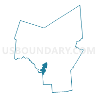
Outline

Summary
| Unique Area Identifier | 632894 |
| Name | Voting District 230002 |
| County | Oneida County |
| State | New York |
| Area (square miles) | 13.55 |
| Land Area (square miles) | 13.54 |
| Water Area (square miles) | 0.01 |
| % of Land Area | 99.92 |
| % of Water Area | 0.08 |
| Latitude of the Internal Point | 43.07068460 |
| Longtitude of the Internal Point | -75.53813470 |
Maps


Graphs
Select a template below for downloading or customizing gragh for Voting District 230002, Oneida County, New York


Neighbors
Neighoring Voting District (by Name) Neighboring Voting District on the Map
- Voting District 020001, Oneida County, NY
- Voting District 150001, Madison County, NY
- Voting District 230001, Oneida County, NY
- Voting District 230003, Oneida County, NY
- Voting District 230004, Oneida County, NY
- Voting District 240001, Oneida County, NY
- Voting District 240005, Oneida County, NY
- Voting District 270004, Oneida County, NY
Top 10 Neighboring County Subdivision (by Population) Neighboring County Subdivision on the Map
- Verona town, Oneida County, NY (6,293)
- Westmoreland town, Oneida County, NY (6,138)
- Vernon town, Oneida County, NY (5,408)
- Stockbridge town, Madison County, NY (2,103)
- Augusta town, Oneida County, NY (2,020)
Top 10 Neighboring Place (by Population) Neighboring Place on the Map
Top 10 Neighboring Unified School District (by Population) Neighboring Unified School District on the Map
- Sherrill City School District, NY (12,553)
- Westmoreland Central School District, NY (6,377)
- Madison Central School District, NY (3,064)
- Stockbridge Valley Central School District, NY (2,885)
Top 10 Neighboring State Legislative District Lower Chamber (by Population) Neighboring State Legislative District Lower Chamber on the Map
Top 10 Neighboring State Legislative District Upper Chamber (by Population) Neighboring State Legislative District Upper Chamber on the Map
Top 10 Neighboring 111th Congressional District (by Population) Neighboring 111th Congressional District on the Map
Top 10 Neighboring Census Tract (by Population) Neighboring Census Tract on the Map
- Census Tract 9406, Madison County, NY (7,129)
- Census Tract 9401, Oneida County, NY (6,293)
- Census Tract 230, Oneida County, NY (6,179)
- Census Tract 9402, Oneida County, NY (5,367)
- Census Tract 256, Oneida County, NY (4,151)
Top 10 Neighboring 5-Digit ZIP Code Tabulation Area (by Population) Neighboring 5-Digit ZIP Code Tabulation Area on the Map
- 13440, NY (42,986)
- 13421, NY (14,125)
- 13478, NY (3,083)
- 13476, NY (3,032)
- 13409, NY (2,374)
- 13477, NY (1,452)